Description
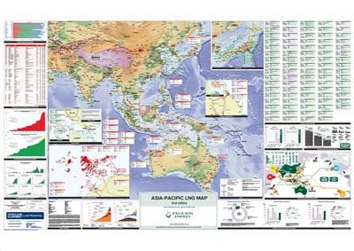
Comprehensive data, charts and
illustrations are used within the map to give authoritative analysis of
trends in the region's LNG industry.
Features
- Mapping:
- Digital terrain model base map of the Asia-Pacific
- Gas pipelines, including those planned, proposed and under construction
- Major gas producing areas/fields
- Oil & gas basins
- Selected oil & gas plays
- LNG import terminals by status [existing and under construction]
- LNG export plants by status [existing and under construction]
- Singapore
- Australia North West Shelf
- Australia Curtis Island
- Japan
- LNG import terminals of Asia-Pacific
- LNG import terminal storage capacity in Asia-Pacific
- LNG production and consumption evolution
- Natural gas - trade movements of LNG in Asia 2016
- Natural gas - proved reserves, production and consumption
- Primary fuel consumption by type in 2016
- Asia-Pacific LNG procurement
- Asia-Pacific floating LNG vessels vs onshore LNG facilities
- Asia-Pacific major LNG shipbuilders (1981 - 2020)
- LNG world trade 2017
- LNG vessel types
