Description
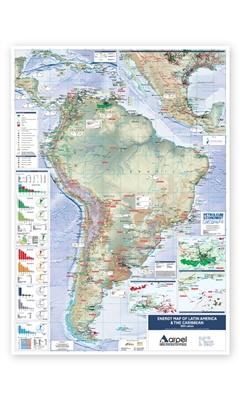
Comprehensive data, charts and illustrations are used within the map to give authoritative analysis of trends in the region's energy industry.
Features
- Mapping content:
- Oil, gas and gas/condensate fields
- Oil and gas pipelines, including those under construction, planned or proposed
- Major gas processing plants & oil refineries
- Tanker terminals & FPSO vessels
- LNG export and import plants, including those under construction, planned and proposed
- Principle coal basins
- Major bio-fuel crop growing areas & tables of bio-fuel production by country
- Power facilities including gas, oil, coal, hydroelectric and nuclear
- Mexico
- Trinidad & Tobago
- Orinoco Oil Belt, Venezuela
- Pre-salt Santos Basin, Brazil
- Electricity imports/exports by country & international electricity interconnections
- Regional primary energy consumption
- Regional oil, gas & coal proved reserves, production and consumption profiles
- Regional electricity generation
Inset maps:
Tables illustrating:
