Description
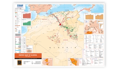
A complete map guide to the oil, gas and general energy infrastructure of Algeria. Comprehensive data, charts and illustrations are used within the map to give authoritative analysis of trends in the region's energy industry.
Features
- Mapping:
- Digital cartography including a fully updated layout from the 2002 edition
- Oil and gas fields,
- Oil and gas pipelines,
- LPG pipelines,
- Condensate pipelines,
- LNG export terminals,
- Gas processing facilities,
- Oil refineries,
- Tanker terminals,
- Petrochemical plants,
- LPG separation plants and
- Helium plants
- Route, length and diameter of Algeria's oil, LPG, condensate and natural gas pipelines;
- Oil and gas production over time;
- Algeria's refining, petrochemical, LNG, LPG and Helium plant assets
- Algeria's exports of LNG and Natural Gas to Europe and North America;
- Trans-Saharan Gas Pipeline; and
- Sonatrach's interests in the Camisea project
